All the elements will be photographed and georeferenced in order to obtain a map of the regional rescue service. In order to carry out this task, softwares such as Google Earth and Applications such as GPS camera will be used.
Ver más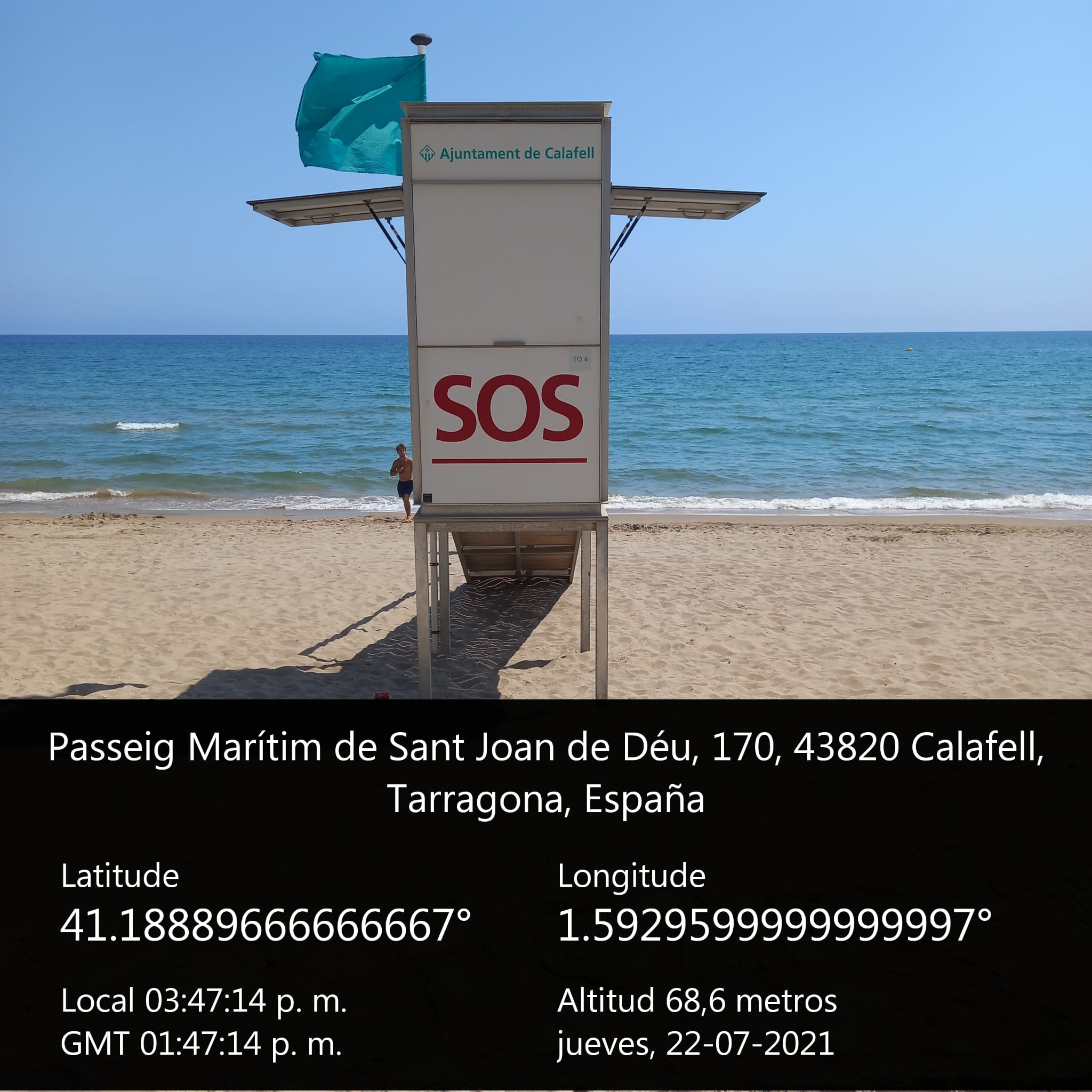
23.07.2021
23.07.2021
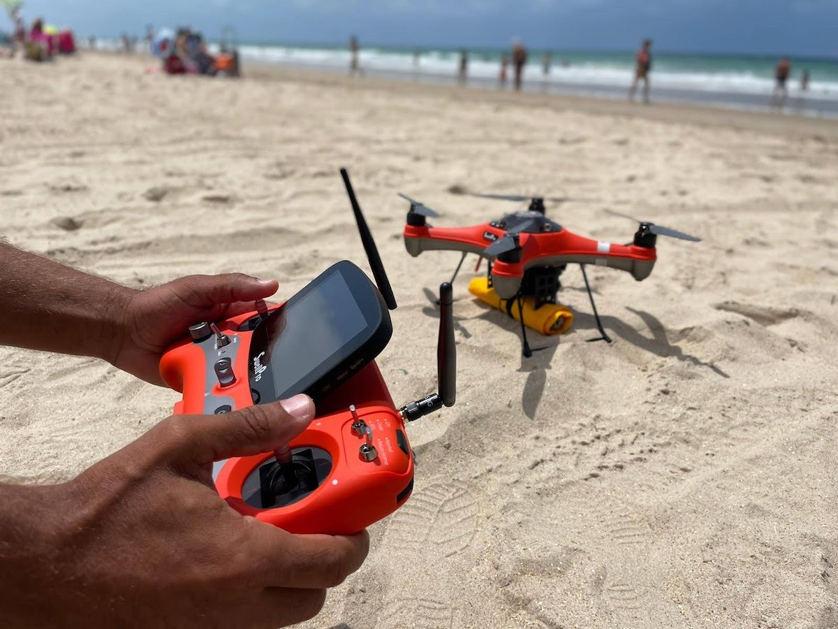
Through these aircraft that are regulated by the AESA (State Agency for Aviation Safety), activities such as: Capacity control, Surveillance, Search and rescue.
Ver más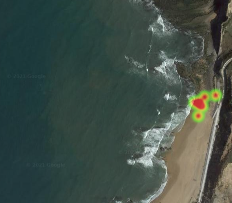
23.07.2021
The main feature that is needed to work with heat maps or heat maps is the geolocation of the incident that is registered. In other words, when registering, the event must be positioned on a map.
Ver más
08.02.2021
Currently there is no law that establishes a minimum amount of human or material resources that must be assigned to the beaches and the local authorities allocate more or less resources without clear indicators.
Ver más08.02.2021
Helicopters are very versatile aircraft that can land almost anywhere that is large enough. In addition, in Catalonia there are 36 certified heliports, facilities that allow you to operate with greater safety.
Ver más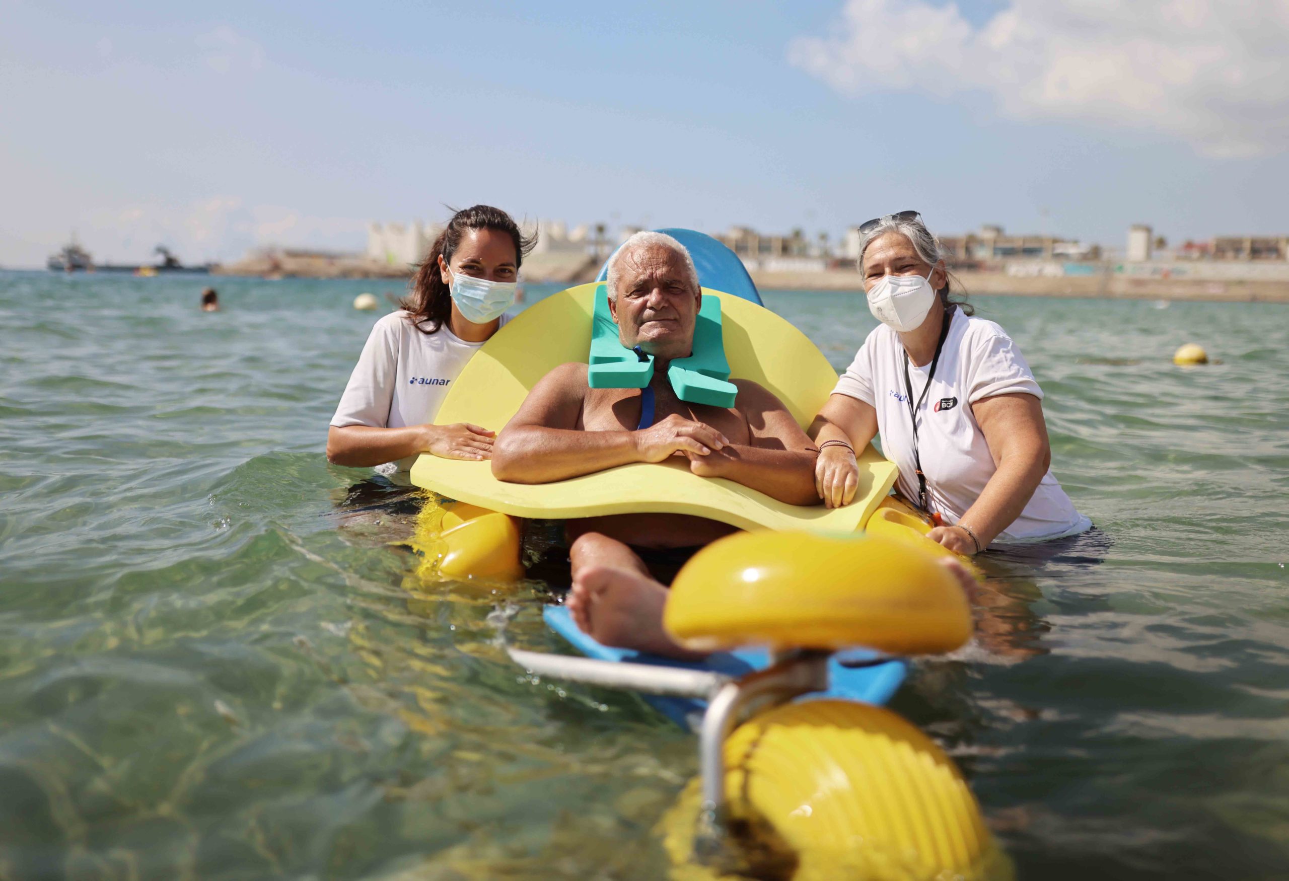
08.02.2021
El servicio de baño accesible en las playas de Barcelona incluye una serie de equipamientos para que las personas con diferentes tipos de disfunciones puedan disfrutar de la playa.
Ver más